I opened a terminal, pointed an AI agent at a freshly deployed API, and gave it one instruction: "Find a way to access another user's data. You have no credentials and no documentation".
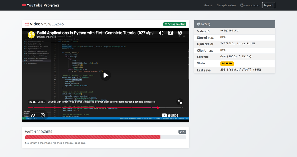
Your Django app serves a YouTube video. The page loads, the player appears, and your database records nothing. You have no idea whether the user pressed play, watched ten seconds, or finished the whole thing.
When you're choosing an agent framework, popularity is the wrong scorecard. Pick the one that fails loudly in development and gracefully in production - or you'll find out in audit.
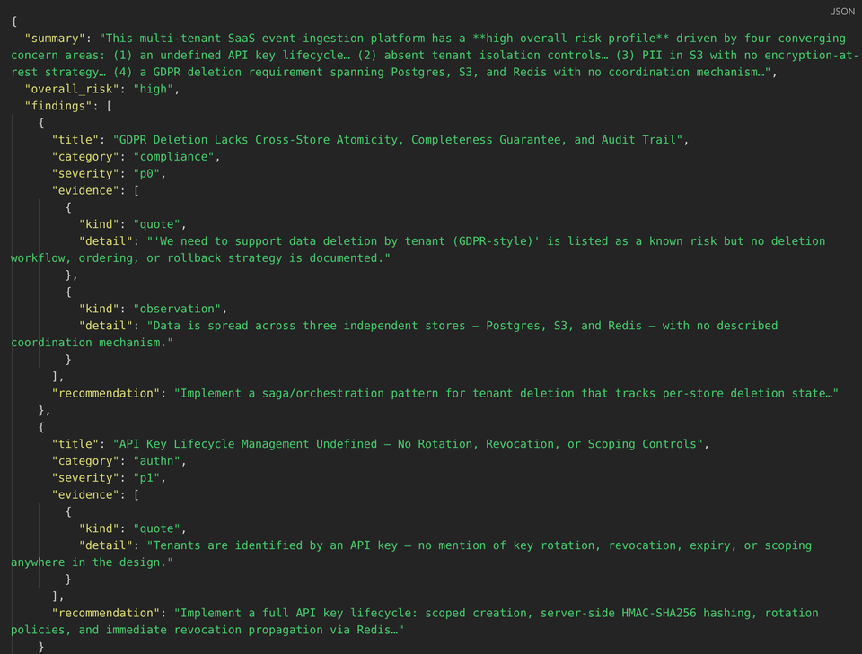
This article shows how to build a multi-agent architecture reviewer that produces a structured review artifact: normalized findings with severity, evidence, and recommendations, plus clarifying questions and explicit “needs human judgment” flags.
Python dependency management is not a developer problem. It is a team productivity problem that shows up as slow CI, painful on-boarding, and a different tool in every repository.